


Clinton Twp. Voting District, St. Louis County, Minnesota
About
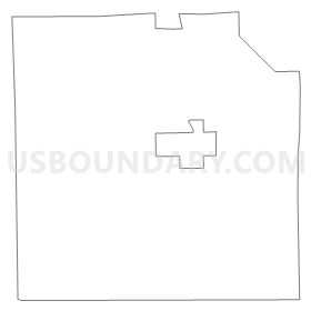
Outline
Summary
| Unique Area Identifier | 604306 |
| Name | Clinton Twp. Voting District |
| County | St. Louis County |
| State | Minnesota |
| Area (square miles) | 33.72 |
| Land Area (square miles) | 33.15 |
| Water Area (square miles) | 0.57 |
| % of Land Area | 98.31 |
| % of Water Area | 1.69 |
| Latitude of the Internal Point | 47.40730420 |
| Longtitude of the Internal Point | -92.62967540 |
Maps


Graphs
Select a template below for downloading or customizing gragh for Clinton Twp. Voting District, St. Louis County, Minnesota


Neighbors
Neighoring Voting District (by Name) Neighboring Voting District on the Map
- Cherry Twp. Voting District, St. Louis County, MN
- Eveleth P-3, St. Louis County, MN
- Fayal Twp. Voting District, St. Louis County, MN
- Great Scott Twp. P-1, St. Louis County, MN
- Iron Junction Voting District, St. Louis County, MN
- Lavell Twp. Voting District, St. Louis County, MN
- McDavitt Twp. Voting District, St. Louis County, MN
- Mountain Iron P-1, St. Louis County, MN
- Mountain Iron P-2, St. Louis County, MN
Top 10 Neighboring County Subdivision (by Population) Neighboring County Subdivision on the Map
- Eveleth city, St. Louis County, MN (3,718)
- Mountain Iron city, St. Louis County, MN (2,869)
- Fayal township, St. Louis County, MN (1,809)
- Clinton township, St. Louis County, MN (1,015)
- Cherry township, St. Louis County, MN (860)
- Great Scott township, St. Louis County, MN (561)
- McDavitt township, St. Louis County, MN (459)
- Lavell township, St. Louis County, MN (303)
- Iron Junction city, St. Louis County, MN (86)
Top 10 Neighboring Place (by Population) Neighboring Place on the Map
Top 10 Neighboring Unified School District (by Population) Neighboring Unified School District on the Map
- St. Louis County School District, MN (17,844)
- Eveleth-Gilbert School District, MN (8,590)
- Mountain Iron-Buhl School District, MN (4,529)
Top 10 Neighboring State Legislative District Lower Chamber (by Population) Neighboring State Legislative District Lower Chamber on the Map
Top 10 Neighboring State Legislative District Upper Chamber (by Population) Neighboring State Legislative District Upper Chamber on the Map
Top 10 Neighboring 111th Congressional District (by Population) Neighboring 111th Congressional District on the Map
Top 10 Neighboring Census Tract (by Population) Neighboring Census Tract on the Map
- Census Tract 133, St. Louis County, MN (3,718)
- Census Tract 128, St. Louis County, MN (2,912)
- Census Tract 134, St. Louis County, MN (2,910)
- Census Tract 127, St. Louis County, MN (2,388)
- Census Tract 113, St. Louis County, MN (2,151)